Total Pageviews

Sunday 14 October 2012

Bellever Tor Circular Walk

The second part of our day in Dartmoor, we decided to try and do a Torr walk, as we were limited to time we thought we would embark on a shorter Torr walk and decided to do Bellever Torr.
There is a car park just before you get into Postbridge (driving from the West), this is a free car park which is always a bonus.


The trail heads south through the coniferous woodland on a main track. The start of the trail is an ascending gradient, enough to get the heart pumping and the legs tingling, a great warm up for the rest of the walk.

The Start of the walk through beautiful forest.

The walk continued through the forest, keep to the right hand side of the track. After about twenty minutes you will come to a small path on the right hand side. This leads to an ancient burial site which is very easy to miss but a good detour to make.

Burial site

The whole area of Lakehead Hill is littered with ancient historic sites, this one being the most visually pleasing though. Once you pass the site turn left onto a marshy trail, this leads you to commanding views of Bellever Torr.

Bellever Torr
 The path here is relatively easy and flat, the clouds at this point were looking a bit ominous but there was no turning back for us so we strove on until we met up with the main path again at the base of the Torr. Here there was an really old wall and stone gate post.
Ancient Farm workings

The path, from this point, was straight an up to the Torr, again nothing too strenuous, just enough to get you heart pumping.

Legend says that the God Baal lived on Bellever Torr, he was the most popular God so being at the centre of Dartmoor, it was the most appropriate place for him to dwell.

My dad's handy camera handywork.
 After a quick break at the top of the Torr,, the granite rocks then point the way to the next stage of the walk across the moor towards Laughter Torr.


The rocks point the way.
 From the vantage point of Bellever Torr we had the worrying sight of dark clouds brewing in the horizon, we hoped and prayed it would not rain but gained our pace and yomped across the moor which was boggy in places, have the good old British summer to thank for that!!


The worrysome sky of the clouds brewing
 When you meet an intersection of walls it was unclear which direction to head, with the trusty map in hand we headed towards Laughter Torr, not sure why it is called this but it looks quite unforgiving and bleak in a cloudy sky. We decided to skirt around the Torr then found a hidden gem, a huge ancient obelisk, one that could have been laid down in asterisk's time, the mood of the clouds made for a mystical photo opportunity.

Standing Stone by Laughter torr


After a short while the small path we were on was intercepted by a main path, here take a left onto the main path which leads you to Bellever Forest, a great contrast to the bleakness of the moors.

The path behind

We came across an old farmstead which looked as though it had not been working for many years, it was called Laughter Hole Farm, a wondrous place and the trees we literally hanging with lichens, the air must be unbelievably clean here.

The Lichen Tree

Laughter Hole Farm
 This place was awash with wildlife, I have never seen so many Goldfinches, a flock of over a hundred flew over us and landed on the most lichen covered tree I have ever seen, not even sure if there was room for leaves


Goldfinch Heaven
 I have never seen a tree like this one, absolutely amazing! looks like someone has thrown a tonne of wet tissue over it, really unusual to see and proven that the air quality in Dartmoor is second to none compared to the highly polluted city of Oxford. The NHS should send people here to get better!

The path continued into the forest again,, a pleasant walk. This then led us to the edge of the forest where there was a picnic area where the East Dart River skirted the forest. This is a beautiful spot with wild ponies and (which excited my father) brown trout swimming in the river.
East Dart River


Dartmoor Ponies?
After a quick bite to eat here and a welcome rest we crossed the Bellever and then walk along the track adjacent to the road, a spiders paradise, for about a mile which took us back to the car.

This was lovely walk, legs were a bit tired at the end, probably due to doing two walks in a day, but this is not that strenuous but you will need a map as the path on the moors disappears a few times. This was a great introduction to Dartmoor and it's history and would recommend it to anyone. Again we were lucky with the weather. Home and a nice pint awaited us in Chulmleigh, a great end to a fantastic day....Dad thanks again.

Friday 5 October 2012

Two Bridges, Wistman's Wood Short Walk


Another Dartmoor excursion was under way, I decided to do two walks today, including this short taster of Dartmoor. The walk starts in a place called Two Bridges slap bang in the middle of Dartmoor, there is a free but small car park opposite the hotel so you may have to get there early especially in holiday season. I had the pleasure of walking with my father again, a very good companion and a very observant one, spotting all sorts of natural wonders that most people would walk past.

 
The Route
The route starts from the car park, go right, through the gate and head along the track, your are instantly transported into the heart of Dartmoor. The walk is quite flat but with a few boulders to scramble over if you wish. as you head towards a farm house, on your left hand side behind the wall in a mini valley. at the time of our walk the trees were teaming in bird life, there were what looked like hundreds of Fieldfare which were pretty ravenous, stripping the trees of the hard grown berries, I thought this was quite early in the year for them as I usually see them in January/ Febuary in Oxfordshire, they must have just migrated in on the latest storms.

The Valley of the Fieldfare
Fieldfare.
To your right hand side were the moors in there stunning iconic bleakness, old farm wall boundaries still litter the landscape giving a sense of history and kind of harsh bleakness to the place especially with old ragged, wind blown trees in the mix.

The Moors
As you skirt past the farm the path splits, the main track heading to Longaford Tor, the track on the left leads you to Wistman's Wood. The valley soon opens out and the wood comes into view, at first sight it looks quite small and unimpressive, just like a copse etched onto the side of a council estate.

The Valley of Wistman's Wood
As we headed towards the wood, the path kind of disappears, you can just make it out as you look at the worn rocks and the trampled plants. after about ten minutes we made it to the wood. Wistman's Wood is a rare relict example of the ancient high-level woodlands of Dartmoor, its name probably derives from Wisht-man's wood, the vernacular word wisht meaning pixie-led or haunted. It is mainly made up of ancient stunted oak and the floor of ancient moss clad boulders, it does amaze me how trees grow out of this eerie boulder landscape. In Devon, the Wild Hunt is said to be that of hellhounds chasing sinners or the unbaptised. The dogs, in the Devonshire dialect, are known as Yeth (Heath) or Wisht Hounds. This legendary hunt is particularly associated with Wistman's Wood hence the name. It really is a truly eerie place and very similar to a previous walk I have done at Black a Tor Copse. Forgive me at this point as I got carried away with my camera.


Wistman's Wood.
Moss Strewn Boulders and Trees.
The Eerie Tree Witch Pointing the Way.
 
Amazing Lichens on the Gnarled Oak Forest.
Had to do another black and white photo.
 
Once we had taken in the atmosphere and enchantment of the place, we had a quick bite to eat and made our way back whenst we came. the weather changed slightly and gave another light on the landscape.
 
On the way back.
 
Rule of thumb is always look behind you especially if you are into photography, the landscape may stay the same but the environment and the feel changes, especially when low clouds come rolling in.
We then passed the wildlife haven and fieldfare valley, I decided to change my lens and get a close up.
 
Fieldfare we thinks.
 
We trudged on for another 15 minutes and made it back to Two bridges, and walked around the hotel and took a view of the Cowsic River, not the most pleasant of names, definitely looks beautiful though.
 
Cowsic River.
 
The Two Bridges Hotel looked a lovely place, probably out of my price bracket, it was formally known as the Saracen's Head which was built in 1794 and was built as a coaching inn, an ideal spot on the only thoroughfare across the moors as it is slap bang in the centre. I bet there were a lot of stories and characters residing in this place.
 
This was the end of the walk, a short but pleasurable walk, no really height gain and no navigation issues. This is a great taster of the moors and may give inspiration to people who have not hiked before to get into the glory of the great outdoors. I definitely recommend this and bet it is even better in the twilight hours of the day to give an air of mystery in the woods and the night sky here would be amazing for all those stargazers who crave no light pollution. this truly was a glorious start to a wonderful day on the moors.

Tuesday 2 October 2012

Lynmouth, Watersmeet Circular

Lynmouth, Watersmeet Circular.

Weather forecast looking favourable for a hike, I decided to see if I could incorporate a walk the involved waterfalls, open farmland and coastal views. Scouring through the local maps of Devon and Google Earth, I found a route which encompassed all of what I wanted and indeed more. I therefore decided to go to Lynmouth and try and find a circular route past Watersmeet and back to the car.

The Route.
After Driving up and down some amazing hills, we made it to Lynmouth, my Father accompanied me on this walk who was rather excited in case he spotted some trout in the river.This North Devon village is a beautiful spot, but looking into it's history suffered a major natural disaster in 1952. On the 15th and 16th of August, nine inches of rain in 24 hours hit here and the surrounding Exmoor, resulting in the East Lyn and the West Lyn rivers turning into torrents which swept down the huge valleys and caused major damage, Overnight, over 100 buildings were destroyed or seriously damaged along with 28 of the 31 bridges, and 38 cars were washed out to sea. In total, 34 people died, with a further 420 made homeless. Due to the nature of the geology and the demographics of where Lynmouth is, this theme was repeated many times, similar events had been recorded at Lynmouth in 1607 and 1796. After the 1952 disaster, the village was rebuilt, including diverting the river around the village.
The start of the route took us through the lovely village, past art galleries and coffee shops until we got to the bridge where we started to follow the river. as soon as we left the village we were in prime ancient oak woodland with the constant noise of the river rushing past at our feet, my Dad was distracted for a while as this was a perfect trout river, crystal clear with rapids and big pools.


The glorious river Lyd
One of many rapids and small falls.

The path by the river has a few ups and downs but is a relatively easy walk and is impossible to get lost. We followed the river for roughly 3/4 of an hour where we past quite a few friendly walkers (a popular route even out of holiday season) past a fly fisherman, my father had to stop and nattered, there really is brown trout in here!! We carried on past a beautiful house and then Watersmeet house came into view. We had to cross a beautiful arched bridge, got half way crossed and saw, upstream, a beautiful two tier waterfall, I'm not sure of it's name but it was quite impressive.

Mystery Falls.
After holding up the other hikers we decided to have a coffee and a bite to eat in Watersmeet House which has been taken over by the National Trust. The cakes took amazing!!! but we refrained and had a snickers bar, my usual walking treat. The house was a former fishing lodge in 1832 and has been a tea house since 1901.

Rest over we then headed towards Countisbury. The ambling we had been doing instantly turned into a very long steep climb out of the valley, which caught one person out who was stopped halfway up, very tired and out of breath. My father jokingly said are you waiting to take a run up? he replied no way, I'm b****y knackered!!!!! (hope he made it to the top). The walk up the valley took you through the heart of this ancient oak woodland, absolutely beautiful and eerie, definitely would be at night.

Through the enchanted Barton wood.
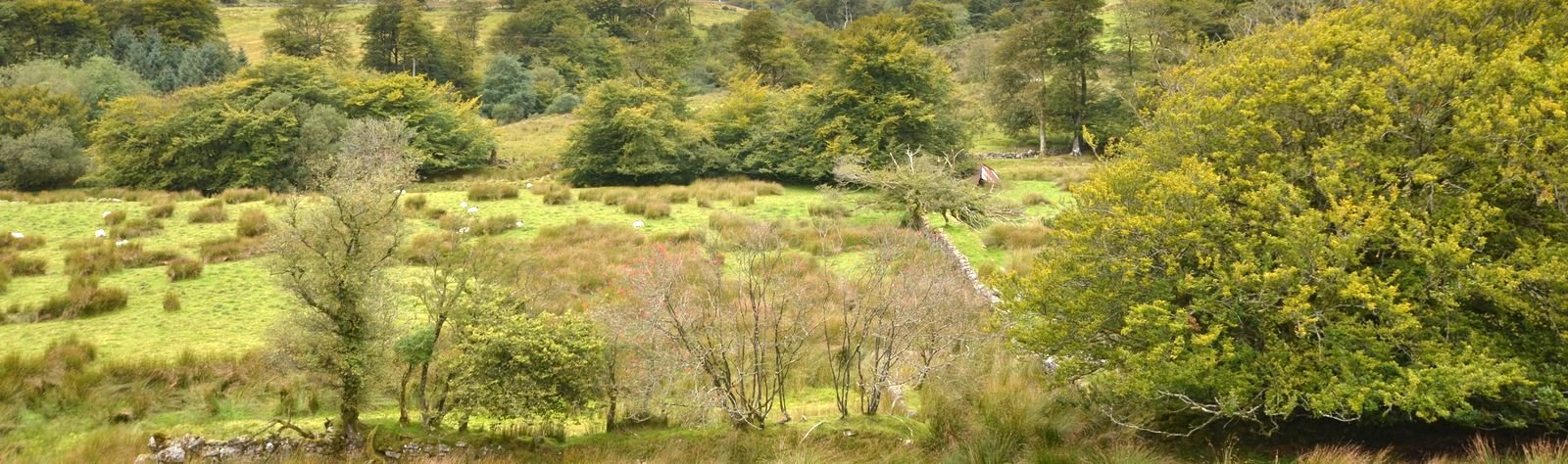
Once we reached the top of the valley, the trees disappeared and the landscape changed into a typical moorland scene only behind you the views of the valley were spectacular.

The Beautiful Lyd Valley

The closer we got to Countisbury, the more the land was managed, we past what look like and ancient dried up pond and went through a few gates until we reached the main road in Countisbury. Head past the pub and the car park and head up the lane towards the church.

A few sheep.


Countisbury Chruch Graveyard.
I definitely recommend having a look inside the church, a wonderful peaceful place and as this trail passes through the church, it is definitely worth a look. It was built in rebuilt in 1796, the original build was much earlier than this. There is a very old and unusual grave stone to the right of the door of the church which look like it is decorated with ancient runes, it is that old the ground covers half of the headstone.
From here we headed up Butter Hill, not sure why it is called that) towards a small communications building which was at that time surrounded by Exmoor ponies. A lovely site as some itched their necks on the walls. They were completely oblivious to us two fools walk around there, they just looked content.


The views of the coast were beautiful here, as we walked away from the building and out to the far reaches of Foreland point we had commanding views either side of us which in the cloud ridden skies gave wonderful shadow effects on the water.

Looking East.

Looking West.

At the end of the path was a bench and a fine place to have lunch as the sun shone and we were sheltered from the wind. Here we mat a lovely couple who were on their honeymoon from Aylesbury and the only people I know who knew Ambrosden where I live. After a quick chat and deer spotting on the hills they left to continue there adventures and the start of there life adventure together. Funnily enough we saw them in Dartmoor a couple of days later, what a small world. we then decided to carry on and wandered past a place called Great red, should call it the blowy place, really windy here.


 We met the South west Coastal Path here which we then followed back to Lynmouth. Halfway down the decent into Lynmouth there was a semi wooded sheltered area which was an absolute wildlife haven, loads of different birds flying around and we met this character ....

Mystery Caterpillar.
Nearer the bottom the path followed the road for a while then veered off into another wooded area where the path got a bit steeper at a place called point perilous, I could see why as out to sea, through the trees, you could see the currents and turbulence on the sea. At the bottom of this path we turned right and walked the promenade of Lynmouth. A lovely area with yet another nice view of where we had been.

The Cliffs of Foreland Point.
We then headed back through the village and back to the car. This was a wonderful walk, not too strenuous, just one steep incline out of the valley. The rest was pretty easy and navigation simple. Again Devon has given me amazing views and people whether locals or not were really friendly, chatty and as for the company of my father.......wonderful. Time to get home and have a nice pint.

Sunday 2 September 2012

Pen Y Fan, Corn Du and the Brecon Beacons

It's the 1st of September, the sun is due out so time for another adventure and this time with the wonderful company of Lucy who I told that I had a relatively easy walk planned, which I think I under estimated in a big way!! We left bright and early from Ambrosden and embarked on a 2 1/2 hour drive to the Brecon Beacons and to the car park before Storey Arms. A little bit hungry on arrival we decided to treat ourselves to a bacon and egg roll from a van called the Pitt Stop, I recommend it, very nice fresh food and a really nice bloke serving, we struggled with the raw Welsh accent a bit but commented politely, not sure what we were agreeing to though!

The map of our journey is thus:-
Did not realise it was a nearly 16km walk.


We started our ascent with the tops of the hills shrouded in clouds, the path was a good walking gradient but incessant with no break in sharpness. as we got half way up the panoramas behind us started to open out in the sunshine.  Fan Fawr looked an inviting walk (one for another time) as the clouds dissipated from it's peak.

The path behind with Fan Fawr
 The  clouds dispersing we trudged onwards up the what seemed at the time a never ending ascent, our legs were feeling it already by this time, (note to self, start jogging at home). the view ahead gave a tantalising glimpse of Corn Du still at this point in the clouds.

Corn Du peaking out of the clouds.
 
We veared round the last corner of the ascent and could see the top, fueled on by the eagerness to see what view awaited us we gathered pace and then saw to our delight the awsome view of the valley of Gwaun Taf with the Neuadd reservoirs glistening in the distance.


This was a great place to recharge our batteries, with a swig of water and a cereal bar we just stood for a while to take in the view, and our breaths. Form this point we could see the arduous path rising up to Corn Du (our first peak of the day). The clouds miraculously vanished from the top, feeling blessed we then tackled the trail up to the top.

Going up the steep path


A bit of a scramble near the top
At the summit there were quite a few people which we found out was a charity walk of about 40 people of all ages and sizes and backgrounds, each spurring one another on, seeing them arrive on the summit looking like the proudest people ever was quite humbling and seeing their sense of acheivement was quite inspiring as soe of them had never been up a mountain before and being bless with the stunning sunny veiw at the top must have made it more special for them, it did me as you could see for miles.
Gwann Taf Valley

Lucy with the Gwann Taf Ridge behind.

The Arty Cairn on top of Corn Du

The seat of the Gods on Corn Du, not for the faint hearted.

The view looking East with Pen Y Fan, Criybn and Fan Y Big in view.

After a quick breather we then headed doen the steep slope towards Pen Y Fan, we did not realize at the time but our heads were starting to get cooked in the sun and the wind, it was very blustery at the top. Advise for any walker, make sure to slap on loads of suntan lotion even if it is not too hot.
We then clambered up to Pen Y fan follwing the charity walkers which made the summit a rather busy place to be, but the people were so friendly and were fortunate enough to get someone to take the photo of us on the summit.


We Made It
 I then had to take a photo of the whole group of charity walkers which is a first for me to take a picture of that many people, no pressure to get a good shot then, especially on someones phone, I really can not use them, hopefully they are all happy and bet there were many tales of their adventures in the pubs and dinner tables.
we then headed down from Pen Y fan and ventured onto a quieter path, deciding not to climb Cribyn and Fan Y Big (legs were shaking a bit from the descent) which was flatter and headed towards the Neuadd reservoirs. The Upper Reservoir was built in 1896 and is the highest reservoir in the Brecon Beacons, the lower one was built in 1884 and the house near there which is bordered up in on the market for 1 million pounds according to one of the local people we stopped and talked to, yet another really friendly Welsh couple. We had to walk accross the lower reservoir which then showed us the path we had to take, all I can say is up!!

The Trail Ahead.
Once away from the reservoir the path became very boggy and very steep, we just set stopping goals as we went up, just to break up the pain and give our hearts some time to recover. The path here is pretty pot luck and have to pave away through the marshes and sttempt to come out of it with dry feet which amazingly enough we managed. The last ascent up to the top of the ridge (Graig Fan Ddu) was very steep with some scrambling, we had two choices, take the boggy path up or take the rocky stream up, the stream was more favorable so attacked that whilst dodging the frogs and grasshoppers. a very welcome rest greeted us at the top.


The first Cairn on the ridge
 From here on the route was pleasant and straightforwards and the views were just amazing.
Lucy on Graig Fan Ddu

A Panorama of the route we had taken

Still a long way to go.
The path was long here but we set a good pace and kept it up for quite a while, we made it to Gwann Taf Ridge then fatigue set it, I could not stop tripping up for some reason, two left feet I think. Gwann Taff Ridge is an amazing place and has a big slab of rock which had sit on me written all over it, so we could not refuse. Here though, not only did we have the views of all the peaks, because is it a ridge the panorams on the other side came into full splendor.
The seat with two views


Tyle Brith and Cefn Crew Valley


 Looking west from the most comfortable rock in the world was the valley of Cefn Crew with Tyle Brith ridge on the right and Cwn Crew ridge on the left with the brecon Beacons reservoir in the distance. It really was a spectacular view especially in the sunshine and having the luxury of a slab of comfy rock to sit on.
We then headed to the end of the ridge and connected with the path to Corn Du the made our long descent back to the carpark. By this time our feet were on fire and legs completly jellyfied, we made it to the car and (a tip for all crazy walker) had the pleasure of taking our boots off. aahhh! so nice.
We were so proud that we made it, the walk took roughly 8 hours rather the the 4 hour stroll I had planned. We are going to feel it in the morning and probably be hobbling around work on Monday.

This walk is up there with the best, you can make it as hard or as easy as you like, the views are amazing and the people we met were really genuine nice folk. With the added bonus of walking with Lou I would rate this walk 5/5, I will definetely be back for more and a bit fitter hopefully.